Pulau Gaya is a sizeable
Malaysian island of 1,465 ha, just 10 minutes off
Kota Kinabalu,
Sabah and forms part of the
Tunku Abdul Rahman National Park. Pulau Gaya derived its name from the
Bajau word "Gayo" which means
big and occupies an area of 15 km² (3,700 acres) with an elevation of up to 300 metres. Several
ridges rise more than 600 feet (180 m), peaking at 1,000 feet (300 m), along the backbone of Pulau Gaya.
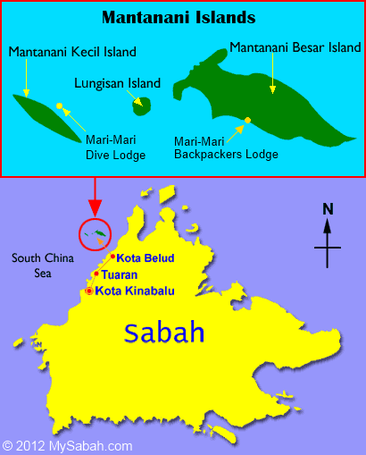
Pulau Gaya is the largest island in the
Tunku Abdul Rahman National Park, closest to downtown
Kota Kinabalu (KK) and is covered with dense virgin,
tropical forest. It has been a forest reserve since 1923. The island has 20km of hiking trails and two 5 star resorts named Gayana Eco Resort, home to the Marine Ecology Research Centre, and Bunga Raya Island Resort on the north-east part of the island.
Historically, Pulau Gaya was also the site of the English colonialist's British North Borneo Company's harbour, razed by the folk hero
Mat Salleh on July 9 1897.
History
Before the Ice Age, it formed part of the Crocker Range mass of sandstone and sedimentary rock on the mainland. However, about one million years ago, the melting ice brought about changes in the sea level and parts of the mainland were cut off by the sea to form the islands of Gaya Island, Sapi Island, Manukan Island, Mamutik Island and Sulug Island. Evidence of this can be seen from the exposed sandstone of the coastline forming the cliffs, caves, honeycombs and deep crevices.
In 1882, the British North Borneo Company set up a trading settlement on Pulau Gaya. After destruction in 1898 the settlement was moved to the mainland in 1899 and named as
Jesselton in honor of Sir Charles Jessel, a manager of the Chartered Company. Later it was renamed to its todays name
Kota Kinabalu.
In 1974, the major part of Pulau Gaya and Pulau Sapi was gazetted as
Tunku Abdul Rahman National Park, covering an area of 8,990 acres (36.4 km
2). In 1979, the park was increased to 12,185 acres (49.31 km
2) with the inclusion of the three nearby islands of Pulau Manukan, Pulau Mamutik and Pulau Sulug. The park is spread over 4,929 hectares, two thirds of which cover the sea.
Activities
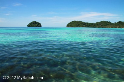
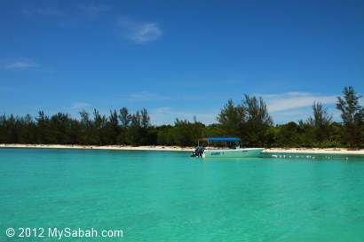
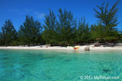
Pulau Gaya is well-known for a legendary beach at Police Bay. The 400 metres (0.25 mile) stretch of white sand, gently slopes out to the sea and makes Police Beach ideal for swimming in the crystal clear water. Police Beach fronts the upmarket Bunga Raya Island Resort.
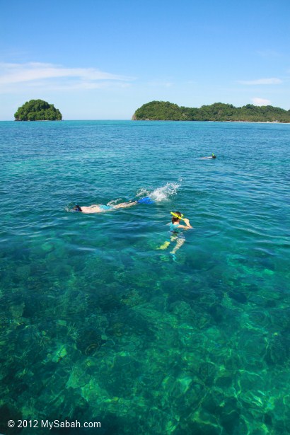
The coral reefs along the entire coast of Gaya island are in excellent condition, making it a surprisingly good diving destination, considering its proximity to
Kota Kinabalu city
Getting There
Jesselton Point Ferry Terminal in downtown
Kota Kinabalu is the ferry terminal for those heading to the islands in
Tunku Abdul Rahman Marine Park (Gaya Island, Sapi Island, Manukan Island, Mamutik Island and Sulug Island). This ferry terminal is also the departure point for patrons staying at either Manukan Island Resort or Gayana Resort
Illegal Settlement
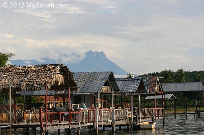
The eastern shore of Pulau Gaya supports a well-known illegal Filipino colony, called
Kampung Lok Urai, with stilt houses girdling the beach as far as the eye can see. It has a 6,000 floating population of largely
Bajau,
Ubian and
Filipinos who provide
Kota Kinabalu with a source of cheap labour. It is considered a dangerous, high crime or "no-go" area by the police and KK locals.
The stilt houses are linked by walkways of weathered planks. As the population grew, new houses spread seaward, with no regard for sanitation. Twice fires wiped out nearly half of Kampung Pondo in 1994 and 1998. The speedboat owners are kept busy, ferrying schoolchildren, then housewives, then traders who sell craftwork at the Filipino market in the
Kota Kinabalu Waterfront.
Both the
Malaysian federal government and the
Sabah state government do not officially recognize the settlement and the inhabitants. The inhabitants are considered illegal immigrants